224.15 +/- Acres - Clay County, MN
**CLICK HERE TO REGISTER & BID FREE ONLINE**
LAND AUCTION
224.15 +/- Acres - Clay County, MN
Wednesday, January 29, 2025 – 10:00 a.m.
Click Here for a Video of the Property!
Auction Location: Courtyard by Marriott - Moorhead, MN
Auction Note: This is remarkable cropland, suitable for the production of sugar beets, soybeans, corn, wheat, dry edible beans, canola, sunflowers and more in Moland Township. This is highly productive cropland with an average Soil Productivity Index (SPI) of 90.6. This property has good access. This is a rare opportunity to expand your operation or add highly productive cropland to your investment portfolio. This land is available immediately for the 2025 crop year.
Contact: Stacy Hurt at 720.291.6186 or stacyh@pifers.com.
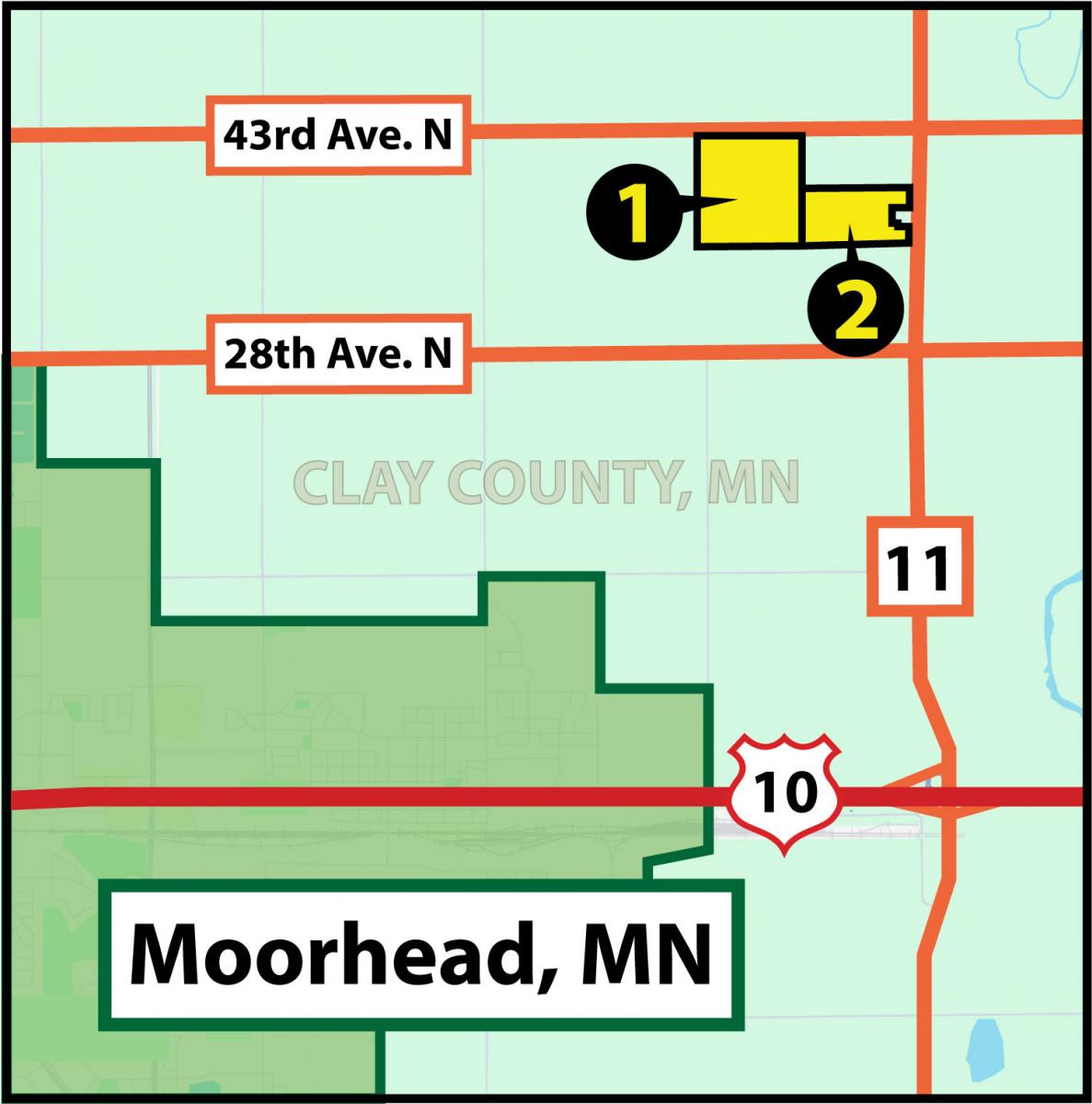
Directions: From Dilworth, MN, proceed one mile east on MN Hwy. #10 to County Rd. #11, then proceed north 2.5 miles on County Rd. #11. This will take you to the SE corner of parcel 2. Proceed a 1/2 mile north on County Rd. #11 to 43rd Ave. N, then proceed 1.5 miles west on 43rd Ave. N to the NE corner of parcel 1.

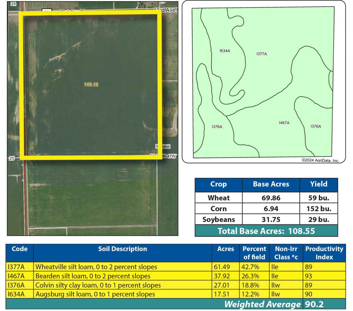
Parcel 1
Acres: 149.18 +/- (Estimate...Final Acres TBD by Survey)
Legal: NW¼ 30-140-47
FSA Crop Acres: 143.93 +/-
Taxes (2024): $9,758.00 (Parcels 1 & 2 Combined)
This is highly productive cropland with an SPI of 90.2. It features Bearden silt loam soil, Wheatville silt loam, and Colvin silty clay loam.

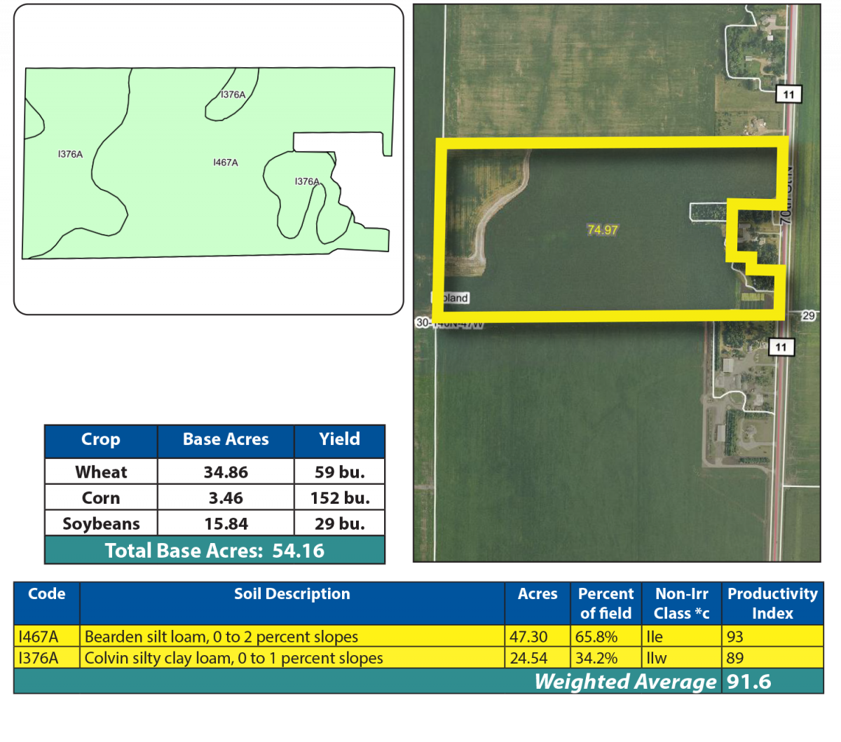
Parcel 2
Acres: 74.97 +/- (Estimate...Final Acres TBD by Survey)
Legal: S½NE¼ Less Farmstead 30-40-147 (Final Legal TBD by Survey)
FSA Crop Acres: 71.22 +/-
Taxes (2024): $9,758.00 (Parcels 1 & 2 Combined)
This is highly productive cropland with an SPI of 91.6. It features Bearden silt loam soil, Wheatville silt loam, and Colvin silty clay loam.

OWNERS: William Wussow & Lawrence Wussow

 Toll Free: 1-877-700-4099